
Our Rendering: The Islands Beneath the Rainbow
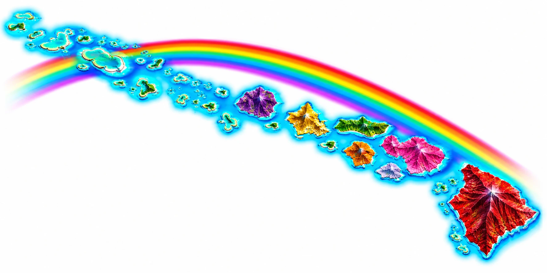
This rendering shows the Hawaiian archipelago as one continuous chain, with a rainbow (ʻānuenue) arcing above it. It is the artwork planned for KHPA license plates.
How each island got its color
Each of the main islands is traditionally linked with a flower or plant, and the rendering gives every island the color of its own. The colors follow those references: the red of the lehua for Hawaiʻi, the pink of the lokelani rose for Maui, and so on around the chain.
- HawaiʻiRedLehua flower
- MauiPinkLokelani rose
- KahoʻolaweGrayHinahina plant
- LānaʻiOrangeKaunaʻoa plant
- MolokaʻiGreenKukui nut flower
- OʻahuYellowʻIlima plant
- KauaʻiPurpleMokihana berry
- NiʻihauWhitePūpū (shell)
Kahoʻolawe’s hinahina is silvery gray, which appears as a pale gray-lavender in the rendering. Niʻihau’s color is white, for the pūpū shells.
Reading the rendering
The chain is laid out as it lies on the map, with the Northwestern Hawaiian Islands trailing off toward the upper left and Hawaiʻi Island anchoring the lower right. Here is where to find each main island:
| Island | Where to find it |
|---|---|
| Hawaiʻi | Red, at the lower right. The largest island. |
| Maui | Pink, to the northwest of Hawaiʻi Island. |
| Kahoʻolawe | A small island just south of Maui, in a pale gray-lavender. |
| Lānaʻi | Orange, between Maui and Molokaʻi. |
| Molokaʻi | Green, long and narrow, north of Lānaʻi. |
| Oʻahu | Yellow-gold, to the northwest of Molokaʻi. |
| Kauaʻi | Purple, the northwesternmost of the main islands. |
| Niʻihau | A small island southwest of Kauaʻi. Its color is white. |
The whole chain
The rendering includes the Northwestern Hawaiian Islands alongside the eight main islands, so the full length of the archipelago, more than 1,500 miles, is in view. The small islands and atolls at the upper left are ringed by turquoise reef and include the places described in Papahānaumokuākea: The Northwestern Chain.
The rainbow
A rainbow begins faintly at the far northwestern end of the chain and arcs across the archipelago, ending near Hawaiʻi Island. A fainter second band runs beneath the main arc.
Plates, registration, and questions
For questions about registration and licensing, see Registration & Licensing. Requirements vary by category and are confirmed by office staff, so contact your island office before visiting, or call the public line at (808) 333-3459.
To learn more about the land shown here, read The Hawaiian Archipelago.